Introducing the Gateway
Welcome to the Winnipesaukee Gateway– Your “one-stop shopping” source for maps, environmental plans, water quality data, recreational opportunities, and more!
We invite you to check out some of the cool features of the site such as the Monitoring Sites Map for lake data, the Stormwater Footprint Calculator, and the Map Atlas. New information and features are always being added, so check back often, and let us know what you think.
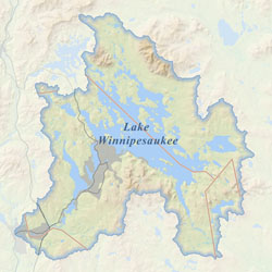
The Winnipesaukee Gateway was created to house the Lake Winnipesaukee Watershed Management Plan. Management Plans are being completed on a sub-watershed basis. Explore the Management Plan tab for more information.

