About
This website is sponsored by a partnership of state, regional and local public agencies, universities and non-profit organizations.
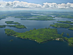
The Winnipesaukee Gateway web site is one element in a broader program to protect and enhance the watershed of Lake Winnipesaukee and the lake itself. The first edition of the site primarily features information about the watershed plan for the Meredith, Saunders and Paugus Bay subwatersheds – future editions will expand other information on the site and provide more detail on these and future watershed planning, monitoring and implementation efforts.
This website was created for the Lakes Region Planning Commission by the consulting team of Applied Geographics and GreenInfo Network in collaboration with Ison Design, using the WordPress web platform.
If you have any questions or comments about the site, please contact us.
PROJECT PARTNERS
Lakes Region Planning Commission: The Lakes Region Planning Commission (LRPC) is a unique governmental association of local communities established to provide planning and leadership on the diverse needs of New Hampshire’s Lakes Region. LRPC’s mission is to provide a quality environment, to increase economic opportunity and to encourage cultural development by supporting local efforts with education, technical assistance, information, advocacy and responsive representation. The commission’s region covers over 1,100 square miles and includes 30 municipalities
The Lake Winnipesaukee Watershed Association: The Lake Winnipesaukee Watershed Association (LWWA) is a non-profit organization dedicated to preserving and protecting the natural resources of Lake Winnipesaukee and its watershed. The organization is comprised of volunteer board members who are concerned citizens and professionals living and working in the watershed, as well as over 300 members. Since the Association’s inception in the 1970’s, it has worked to maintain and enhance natural resources through education, technical assistance and community partnerships in the Lake Winnipesaukee watershed.
OTHER PARTNERS
The following partners have been actively involved in the development of the watershed planning that is featured on this web site:
- North Country Resource Conservation & Development Area Council (NCRC&D)
- University of New Hampshire Center for Freshwater Biology (UNH CFB)
- Belknap County Conservation District (BCCD)
- Plymouth State University Center for the Environment (PSU CFE)
- City of Laconia
- Town of Meredith
- Town of Gilford
- NH LAKES
- New Hampshire Department of Environmental Services (DES)
FUNDERS
Funding for the management plan and the watershed portal has been provided in part by a Watershed Assistance Grant from the New Hampshire Department of Environmental Services, with Clean Water Act Section 319 funds from the U.S. Environmental Protection Agency, and funding from the National Oceanographic and Atmospheric Administration (NOAA).
We would also like to thank and acknowledge the Samuel P. Pardoe Foundation for providing funding for the Interactive Water Quality Data map, the stormwater footprint calculator, and the map atlas.
